The glacial and post-glacial geology of the lower Laurentians, where Terrebonne sits on the north shore of the Rivière des Mille Îles, creates a subsurface that is rarely uniform. Compact till, marine clays from the Champlain Sea, and irregular rockhead elevations all coexist within short distances. When a project requires knowing exactly where the bedrock begins or where a buried channel cuts through the overburden, a conventional borehole log provides only one data point. For projects on the Mascouche or La Plaine sides, we often combine seismic tomography with a test pit program to ground-truth the velocity model against direct observation. The resulting section gives the project structural engineer a continuous profile of the ground, which is especially useful in residential developments where the terrain rises toward the Laurentian foothills.
A seismic velocity section answers the question that a grid of boreholes cannot: what happens between the points where you stopped drilling?
Methodology applied in Terrebonne
- Continuous imaging of bedrock surface beneath irregular overburden.
- Detection of fractured or weathered zones within the rock mass.
- Mapping of buried valleys infilled with compressible organic silt or loose sand.
- Rippability assessment based on seismic velocity ranges correlated with the Caterpillar D9R to D11R performance charts and local Grenville rock experience.
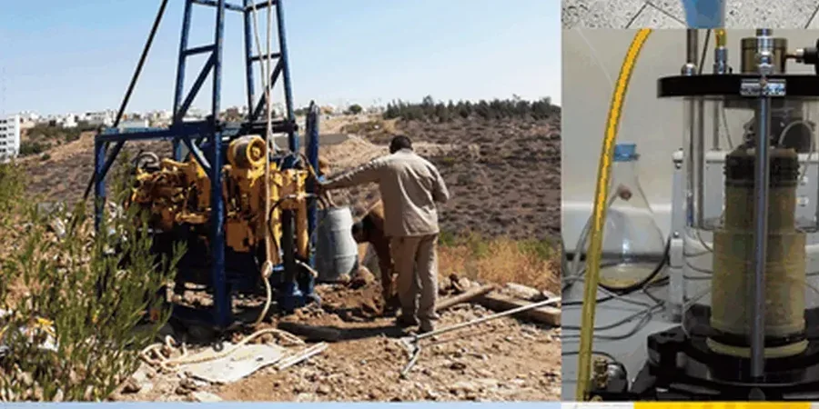
Demonstration video
Local geotechnical conditions in Terrebonne
Terrebonne grew from an 18th-century seigneurie into a modern suburb, and that growth has pushed construction onto terrain that was once considered marginal: the low-lying clay plains near the Mille Îles and the peat-filled depressions east of Autoroute 25. The Champlain Sea clay is sensitive and can lose strength when remoulded; its thickness varies from a few metres near the old town to over 30 metres in the former agricultural lots. Seismic tomography reduces the uncertainty in the depth-to-bedrock model, which directly influences earthwork quantities, dewatering design, and the choice between shallow footings and deep foundations. The technique also helps identify lateral velocity anomalies that may indicate a buried channel filled with compressible organic material, a condition that would otherwise only be found by drilling on an unrealistically tight grid. A well-executed tomographic survey diminishes the probability of excavation surprises during the foundation phase.
Our services
Every seismic tomography project in Terrebonne starts with a clear definition of the target: is it bedrock depth alone, or also the internal structure of the overburden? The answer determines whether refraction, reflection, or a hybrid approach is appropriate. We also factor in the ambient noise environment — working near Highway 640 or the commuter rail line requires different acquisition parameters than a quiet site in the residential grid of Lachenaie.
Refraction Microtremor (ReMi) and MASW
When shear-wave velocity is required for NBCC site classification, we combine active-source refraction with passive-source ReMi or active MASW along the same geophone spread. This yields a one-dimensional or two-dimensional Vs profile without mobilizing a separate crew.
Crosshole and Downhole Seismic
For critical structures where the highest resolution is needed, we perform crosshole or downhole surveys between cased boreholes. This gives a direct measurement of P-wave and S-wave velocity versus depth, calibrated against the geological log.
Questions and answers
What is the typical cost of a seismic refraction survey in the Terrebonne area?
For a standard refraction line of 115 metres (24 geophones at 5 m spacing) with sledgehammer source, the cost generally falls between CA$3,720 and CA$6,100, depending on the number of shot points, site accessibility, and the complexity of data processing. A site covered with dense brush or located on a steep slope will require additional preparation time, which is reflected in the final price. We always provide a fixed-price proposal after reviewing the project coordinates and objectives.
How does seismic tomography complement a geotechnical drilling program?
Drilling gives you a precise stratigraphic column at a single location; seismic tomography gives you a continuous image of the interfaces between those columns. In the Terrebonne area, where the bedrock surface can be highly irregular, a tomographic line run between boreholes can reveal pinnacles, troughs, and fracture zones that would otherwise go undetected. The calibrated velocity model also helps estimate rippability and excavation difficulty across the entire site, reducing the risk of claims during earthworks.
Can you perform a seismic survey in winter on the North Shore?
Yes, and in some ways winter is the best season for seismic work in Terrebonne. The frozen ground provides excellent geophone coupling, and the absence of leaves and undergrowth makes line cutting much faster. The main limitation is that a thick frost layer can alter the near-surface velocity, so we adjust the inversion parameters accordingly and, if necessary, drill through the frost to place the source at the unfrozen soil surface. We have completed refraction surveys at temperatures down to −20 °C without any loss of data quality.